Park Place: Walk Stars
There are more than 125 miles of trails within the park. here are five standout hikes to get you started
Ledges Trail
Ritchie Ledges offers the most alien landscape you'll find in the park: huge Sharon
conglomerate rock formations created from compressed sediment millions of years
ago when the area was covered by a swamp. Erosion carved the walls of stone that
have become a must-visit spot. Walk past the picnic shelter at the north end of
the parking lot, and you'll come to trails heading in various directions. Go right
and you'll find huge rock formations and hemlock trees that thrive in the cool,
moist environment here. Moss covers stone, and sunlight filters in through the trees,
offering plenty of photo opportunities. (The popular Ice Box Cave is located in
this portion of the trail, but visitors are no longer allowed inside due to the
spread of white nose syndrome — a disease that's decimating bat populations.) Near
the loop's north end, a stairway crafted with stone quarried from the ledges and
then fit into a natural break in the rocks enters from the left, but stay on the
trail. As you circle around to the Ledges' west side, the rock formations grow higher
and higher, until you reach the sign near the loop's southern-most point directing
you to the Ledges Overlook. One of Cuyahoga Valley National Park's signature spots,
the peaceful perch offers a stunning canopy-level view of the surrounding forest.
Our Advice: Don't miss the other trails nearby. After finishing
the Ledges Trail, tackle the immediately adjacent Haskell Run Trail (an easy half-mile
loop near Happy Days Lodge) or Pine Grove Trail (a moderately challenging 1.5 mile
loop to the west that's an easy half-mile walk away).
Distance: 1.8 miles Elevation Change: 105 Feet
Park Difficulty Rating: Moderate Trailhead:
Kendall Park Road, 1 mile west of Akron Cleveland Road, Boston Heights
Brandywine Gorge Trail
Brandywine Falls is one of the most beautiful spots in the Cuyahoga Valley, but
you're missing out if you don't explore the gorge that surrounds it, too. The National
Park Service rates this hike moderate to difficult, which is mainly for a steep
set of stairs on one side of the loop trail and a rocky rise on the other. It isn't
stroller territory, but kids can handle this popular family hike without too much
trouble. From the parking lot, take a left on the asphalt path rather than continue
on to the boardwalk that descends to the falls. A sign points you into the forest
and then down those aforementioned stairs before winding through the woods and across
a long, narrow bridge that traverses Brandywine Creek. This is a meandering hike
with views that coax you to take it slow and a rocky path that encourages minding
your step. The trail empties onto the Summit County Bike & Hike Trail, which
curves past the Inn at Brandywine Falls and then around to the boardwalks, where
you can climb down (pictured) and take in the grand finale of this popular park
stop. Our Advice: We like to do this hike clockwise because the
climb back out of the gorge comes with a reward of a bench near the top, where you
can stop and take in the rushing sounds of Brandywine Falls just beyond your view.
Distance: 1.4 miles Elevation Change: 160 Feet
Park Difficulty Rating: Moderate to difficult Trailhead:
8176 Brandywine Road Sagamore Hills
Buckeye Trail: Pine Lane to Boston
Although the Park Service suggests going from Boston to Pine Lane, we go the opposite
way so the first leg of the hike passes through a cool and shady forest. This pleasant
portion of the statewide Buckeye Trail climbs and dips and even asks hikers to cross
a small stream (don't sweat it). A highlight of the hike comes midway through as
the trail enters a long column of tall pines (pictured). Don't be surprised when
the pine-needle-covered path empties onto Boston Mills Road and a view of Ohio Turnpike
traffic rushing below. Use the walking lane to cross over the highway and look for
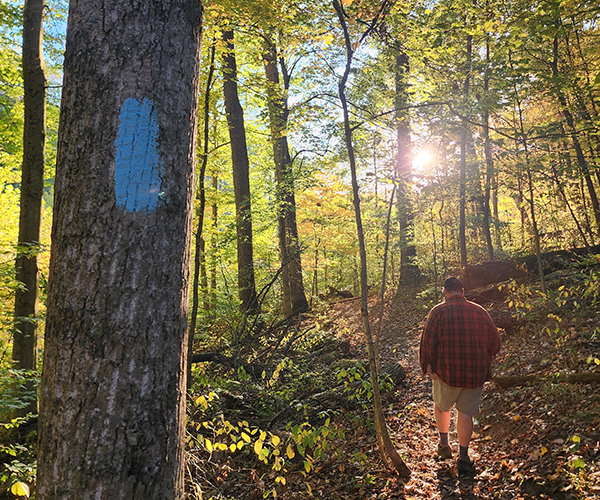
the Buckeye Trail's light blue marker on the right identifying a path that heads
back into the woods and on to the historic Boston Store. For the return trip, head
south on the Ohio & Erie Canal Towpath Trail, an easy and scenic walk that takes
you over Stumpy Basin boardwalk and along the Cuyahoga River to Peninsula. When
you get there, head into town and take a left on the main drag, state Route 303,
and walk until you see Dell Road entering from your left. Follow it back up to the
Pine Lane trailhead. Our Advice: Pine Lane has limited parking, but
downtown Peninsula has much more, with a main lot and overflow parking at Lock 29
as well as street parking.
Distance: 4 miles, round trip 7.4 miles Elevation Change:
240 Feet Park Difficulty Rating: Moderate Trailhead:
State Rt. 303, 1/2 mile east of Riverview Road, Peninsula
Lake Trail
More like an afternoon stroll than a hike, the trail around Kendall Lake offers
an easy loop fit for everyone. The picturesque lake is no accident of nature. The
Civilian Conservation Corps created it in the 1930s, along with the shoreline shelter
house and boardwalk jutting into the lake (pictured). If you're wondering about
the curious cement tunnel along the trail that cuts through a tree-covered slope,
it was a bypass created for hikers when the place had a winter toboggan chute. Relaxation
is the main pursuit here, so pack a picnic, kick back and take in the scenery. For
those who prefer an afternoon of kicking up dust on the trail, there are two places
to explore nearby: The Salt Run Trail's moderately difficult 3.3-mile loop is easily
accessible from the Lake Trail's western edge. If rolling (but still challenging)
hills are more your speed, a 2.5-mile cross-country circuit is accessible via the
south end of the lake loop. Our Advice: If you're traveling light
and want to make your picnic more of an adventure than walking 100 feet from a parking
lot, park at the Pine Hollow trailhead along Quick Road (a mile east of Akron-Peninsula
Road), which offers a brief-but-beautiful stroll over the rolling Kendall Hills
on your way to Kendall Lake.
Distance: 1 mile Elevation Change: 20 Feet Park Difficulty Rating: Easy Trailhead: Kendall
Park Road, 1.6 miles west of Akron Cleveland Road, Boston Heights
Tree Farm Trail
The Tree Farm Trail is easy to overlook given the many national park paths that
meander past rocks and climb up and down hills. But those looking for a contemplative
walk in the woods will find it here at this easily accessible yet secluded spot
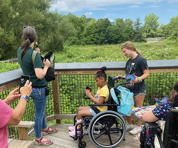
off the Horseshoe Pond Trailhead in Peninsula. A paved, wheelchair-accessible path
leads visitors to the pond and picnic shelter beyond, but hikers should head off
to the right and look for the sign that marks the Tree Farm Trail. Shady groves
of pines are interspersed with sunlight-drenched stretches. During our late spring
visit, yellow and white wildflowers dotted the edges of the trail, which changes
from tramped down grass to bare ground and back a handful of times during the walk.
And yes, there's an actual tree farm here — the privately owned Heritage Farms —
where you can get a nice view of neat and orderly rows of pine trees in different
stages of growth (pictured). The long, quiet walk pays off when the last grove of
pines empties you along the pond's northeast edge. Our Advice:
Traverse the loop trail counterclockwise as we've outlined it here. That way, it
ends at the northeast edge of Horseshoe Pond rather than starts there. The quiet
spot is the perfect place to grab a patch of grass and take in the scenery, and
that's best enjoyed after a nearly 3-mile hike rather than before it.
Distance: 2.75 miles Elevation Change: 80 Feet
Park Difficulty Rating: Easy to moderate Trailhead:
Major Road, 7/10 of a mile west of Riverview Road, Peninsula


